Saturday, 25 April 2015

25 April. Mile 369: Wrightwood. Americana.

I took a "double zero" [two(!) days off without hiking] in Cajon Pass, given forecasts for thunderstorms in Wrightwood on Thursday.  The National Weather Service issued a flash flood warning on Thursday afternoon for an area including Wrightwood, and apparently there was a great deal of rain and even hail in town.

Friday was a 5am start, with a pre-dawn, 1,500 calorie McDonald's breakfast fueling a 25 mile, 13 hour day (breakfast can't have been healthy, but it did help for a long hike).  The early start and cool temperatures during the day allowed me to get to Wrightwood that same evening, despite the extra water I carried (no sources on the way) and the extra time I took to avoid the rash-inducing poodle-dog bush.  I feel like my 2 mile per hour pace is on the slow side.  I'm being passed way more often than passing others.

Wrightwood is another small town on the trail that seems to be doing well.  All the houses and cars seem are up to date and in apple pie order.  There aren't as many for sale signs as elsewhere.  In the compact downtown, there are Saturday morning youth t-ball and softball games at the school ballfields across the street from the elderly cabins of the hotel I'm staying at.  The Wrightwood History Museum provides an overview of the town and region, and the coffee shops are full of locals relaxing on their weekends.  And, like Idyllwild, there are a prominent video store and acupuncturist.  Slice of Americana!

Above the clouds in the San Gabriel Mountains, approaching Wrightwood

In the clouds!

Historic signs at the Wrightwood History Museum

Thursday, 23 April 2015

Reflections.

When I left India, I sold or gave away most of my belongings.  Practically speaking, I had nowhere to store them, nor did I have time to receive a shipment in the U.S., as I was planning to hit the trail two weeks after returning.  Many items weren't difficult to part with, but others held more value, and took a second thought or two.  Now, on the trail, I have to carry everything in my pack.  The weight creates incentive to shed belongings, rather than accumulate them.

Still, when stopping in town to resupply, I find shopping fun.  Top of the list is food.  It's challenging to eat enough calories on the trail, so town meals trend toward the super-sized, in response to the body's demand for fuel.  In terms of trail provisions, I've added candy to my mix, and I'm revisiting the sweets of my childhood: Runts, Skittles, jelly beans, and, from the Idyllwild candy emporium, root beer sticks, gum drops, and Choward's violet mints.

The towns so far have been tourist towns.  The local artwork galleries have been a treat for the eyes, which, on the trail, have had an extended break from the dizzying parade of images and text that usually march across glowing screens throughout the day.  The dresses and tops presented for sale, while designed for women, are a stylish contrast to the functional, wickable fabrics and shiny ultralight down jackets of the trail.

Shopping is in particular a break with the daily routine of the trail, which, to my corporate-trained mind, I find myself now thinking as a set of standard operating procedures (in acronym terms, SOPs).  I wake up around 6ish, and, depending on the temperatures, may remain in my sleeping bag for a bit longer.  Then, a cold breakfast in my tend, followed by packing up my sleeping bag, changing clothes, and then repacking my bag and taking down my tent, all in that order, and each step with its own set of sub-routines.  This always seems to take at least an hour.

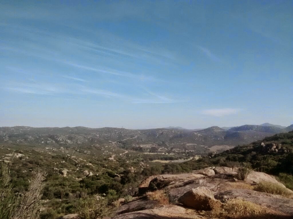
The day's hike will be on the order of 10-11 hours, including breaks, with planned stops for water and an end point objective in mind.  Throughout the day, I'll consider my pace, distance to travel, and time remaining (like tracking required run rates in limited overs cricket).  At water sources, filtering water requires what I consider its own eight-step procedure (from which when I've deviated I've knocked over the water bottle twice).

At the end of the day, I've often been stretching to the last bit of daylight, so I arrive at a flat piece of ground, put on a jacket, set up my tent, eat some food, and change out of my hiking clothes, exchanging my boots for a pair of Locals flip flops (possibly the unofficial official footware of the Hawaiian Islands), all the while racing against the clock and the cold and wind that have typically accompanied sunset.  In my tent, I plan or rereview the next day's schedule, and then it's a mixed night's sleep, interrupted by the wind or constant shifting in a search for a more comfortable sleeping position.  And then, it's morning, and time to start over again.

I imagine many hikers, after a few weeks, will note that they find something comfortable about the daily routine, and that town stops, while something different, are welcome only as a break, and there's quickly a yearning to return to the trail, and to hiking and to scenery and accompanying thoughts.

Wednesday, 22 April 2015

21 April. Mile 342: Cajon Pass. Update.

As expected, the terrain out of Big Bear has been less intense.  The last three days have been 20+ miles per day, and, while they have not been painless, they have been manageable.  I've arrived at Cajon Pass, a rest stop on Interstate 15, the route between Los Angeles and Las Vegas.  The next stretch of the trail on paper looks challenging - a 30 mile waterless stretch, with a 5,000+ foot elevation gain, and with the infamous "poodle-dog bush" in the terrain.  The shrub thrives in areas after fires and causes severe irritation if touched, apparently much worse than poison ivy or poison oak.

The weather cooled significantly today, though, and rain is in the forecast, so I might end up waiting out the rain.

Mission Creek

Big Bear Lake

Up in the clouds, overlooking Silverwood Lake

This seemed to be a picturesque stretch of the PCT

Friday, 17 April 2015

17 April. Mile 266 Big Bear City. Changes.


The hiking coming out of Idyllwild to Big Bear City has been challenging.  The ascent out of Idyllwild toward and beyond Mount San Jacinto involved more than a mile in elevation gains, weighted with a pack full of food for five+ days, plus four liters of water at the end of that day.  That actually wasn't enough water, though, as I ran out at 3pm the next day during the decscent out of the San Jacinto range -- that day was a decline of 6000+ feet down a slope fully exposed to sun, with occasional narrow trail ledges and overgrown pathways.  Luckily I got to the "water fountain in the desert" at the bottom of the range (maintained by the local water agency) just over an hour later.  It's been another overall 8000 feet in elevation gains over Tuesday-Thursday, and I'm taking a rest day in Big Bear City.

The euphoria and trepidation of the first few days has worn off.  There are ups and downs with the scenery and how my body is feeling.  The rest in Idyllwild was key for being able to handle the strains of the past week.  The difficulty of the terrain coming up looks moderate, so I'm expecting the next couple of days to go okay.  Temperatures wise, in this area the nights are down to freezing levels; that's been challenging.

View of Idyllwild from above

Coming down from San Jacinto, view of the Interstate 10 corridor, artery between Los Angeles and Phoenix.

Redwood trees on the way to Big Bear City

Saturday, 11 April 2015

11 April: Mile 179, Idyllwild. Water.

Seventy miles on, and several thousand feet up and down, I've arrived in Idyllwild in the San Jacinto mountains and have taken a day off from hiking to rest my feet.  The weather has cooled this week, taking nighttime temperatures below freezing, and stretching the limits of my gear.  Tuesday night there was a storm across California, and I was fortunate that I was able to find shelter from the winds in the form of a motorhome used for trail hikers at the home of "Trail Angel Mike" (trail angels volunteer their time and assistance to hikers).  Hiking out of the San Jacintos will involve quite a few more ups and downs.

In this first part of the trail, the availability of water drives much of the approach.  Much of the terrain is effectively desert, and water is limited.  The sources I and other hikers have used so far have been predominamtly manmade tanks or piped springs; the minority have been natural running water.

Most water sources require some kind treatment and are not potable.  The majority of hikers use of of two approaches: either using a filter, which screens out particles and most all germs but can be prone to clogging, or else using a chlorine dioxide treatment, which treats the water entirely but doesn't address particulates.  My preference has been the filter.  Both approaches require waiting, and every day requires some time devoted to planning out water.  Water is heavy, at more than 2 pounds per liter.  When water sources are 15 miles apart, then you've got more to carry.

Water is a constant news topic given California's historic drought.  The PCT landscape also has constant reminders of past fires; there are several miles of the trail approaching Idyllwild that are closed due to the 2013 'Mountain' fire.  You might say I've a bit for conserving water by machine washing my clothes for the first time since hitting the trail...


An usually long flat stretch to the trail outside Warner Springs

Eagle Rock, outside Warner Springs

Unexpected shelter from this week's storm


Monday, 6 April 2015

Mile 109.5, to Warner Springs. Flora.

Mile 109.5, to Warner Springs.  Flora.

6 April 15: Yesterday I hiked 22 miles through and out of the San Felipe hills, much of it with an uncomfortably strong wind.  I camped at Barrel Springs for the night, with loud frogs at the spring and traffic on the nearby road.

The landscape along the PCT so far has changed daily.  During a break, which coincided with a break in the wind, I smelled a strong scent and realized that there's a great deal of sage growing in the San Felipe hills (see photo below).  You can take sage leaves, fry them in butter, and combine this with pasta, Parmesan, and black pepper.  A lovely dish (and veg-friendly, with the right pasta).

The cacti are blooming (see the other photo below).  In Mexico, eating a certain cactus, called nopal, is a common dish, and one that I had several times a week while studying there.  I've not seen nopal in tex-mex restaurants.

There were agave plants everywhere, which made me think of mezcal, tequila, and cold margaritas, with salt on the rims of the glass.  (No alcohol so far on the trail.)

Sadly, none of the above are on my diet on the trail.  I have started "stoveless" (to save weight), meaning I am not carrying a camp stove and fuel for boiling water for things like ramen/maggi or instant potatos.  I am eating dehydrated granola/bananas (just add water), dehydrated beans and rice (which actually taste fine rehydrated in cold water, but it takes more time to rehydrate), trail mix (the Costco Kirkland brand, a blend of peanuts, almonds, cashews, raisins, and just enough M&M's to give a contrasting taste of sweet chocolate, pop tarts, emergy bars, and, to spare any veg readers the details, various meat products sealed for individual servings.

As I progress, I'm positive my menu will evolve.  I've arrived in Warner Springs for lunch; burger, soda, pie and ice cream.  And a shower, a wonderful shower.  The community center sets up a welcome center for hikers -- really nice and well done.  Picking up more trail mix that I mailed to myself at the post office...


Sunday, 5 April 2015

Day 5: San Felipe hills

The scenery from Mount Laguna onward has been beautiful.  The hiking terrain and elevation changes vary by day.  Weather has been fine.  Spent Friday night camped in the San Felipe hills.  Very windy!  79 miles in.


Thursday, 2 April 2015

Day 3: Tollgate

Schedule: Green
Gear: Green
Physical fitness: Yellow
Mental fitness: Green

Schedule: Green.  I've reached Mount Laguna, as I'd planned.  About 42 miles in, over just about 2.5 days.

Gear: Green.  Most everything has worked well.  Though my toiletries hid themselves at the bottom of my bag, and I wonder how long the gear will last.  It's being well used.  The trail is rough on gear.  And, it'd always be nice to get lighter.

Physical fitness: Yellow.  I knew that a lack of physical training would make things difficult.  In India, I didn't make the time to train (though, trying to complete two major deliverables up to the day I departed, completing all the logistical its that come with a cross-border move, and dealing with other personal items limited my time).  So I was ready for things to be painful.   The good news - no blisters.  But my body is definitely being pushed.  The weather has been good; sun is extremly strong, but the air temps have been in the 70s/20s.  It was a good feeling to end at 3 today and to get a shower and a bed at the Mount Laguna lodge.  I expect the short break will help me recover.

Mental fitness: Green (though my coworkers may disagree given the title of this post!).  On the whole, feeling good!  The scenery is beautiful, the air is fresh and clear, and it's a good feeling being out on the trail.  Being a novice camper, I'm learning more each day.  There's plenty more I still need to work out and will write about later.

Tips for hikers that I haven't seen before:
* The San Diego 894 bus line to Campo leaves from the "rural stop" bus stop from El Cajon transit center.  There won't be a route sign labeled 894; look for the "rural stop" sign listed next to one of the stops.  At the moment, the rural stop is immediately across from the trolley stop, right next to the convenience store in the island in the middle of the bus stops.
*I've found that trail runners all seem to be too narrow for my feet.  So I've gone with hiking shoes instead -- Merill Ventilators, wide model.  These might be heavier, but no blisters so far!
*I recommend bringing handgloves; I've  needed these to ward off blisters on my hands from hiking poles.