Water defines the southern section of the trail. You ensured over the course of any given day that there was a source to fill up at, and these locations impacted your schedules and overnight stops.
In this section of the Sierras, mountain passes have been the key factor. At 11-12,000 feet, the passes bring thin air altitudes, steep elevation changes, and snow to the trail. I tried to position myself every evening close to the next pass in order to make use of the frozen, packed snow the next morning, in contrast to the soft snow of midday/afternoon. Going from south to north, the descents from these passes into the snow on the north faces can be tricky. With significant snow cover, there's no trail to follow; you have to work your way down through the snow.
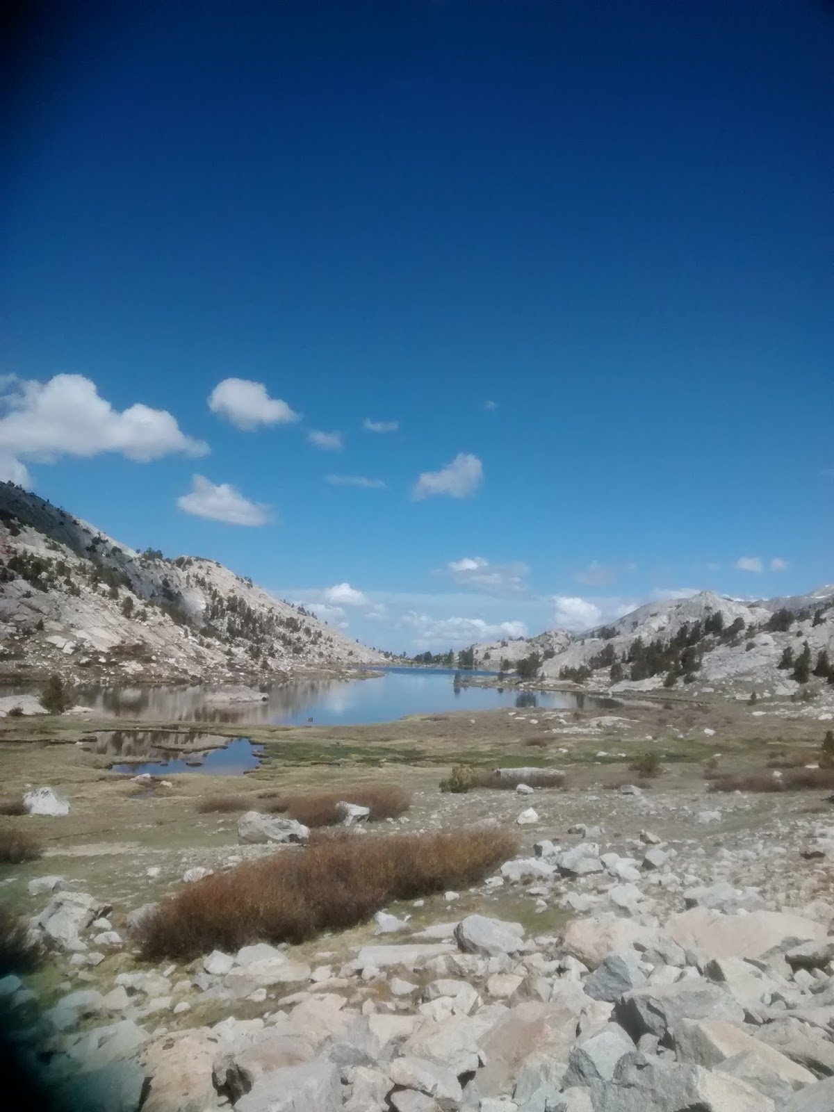
The scenery is stunning, however. Over every pass is another alpine valley or series of lakes. The air is clear and free of haze or pollution. Presently, what snow has fallen last winter is melting, and there are creeks and streams of crystal clear running water everywhere (unfortunately for California, in another few weeks many of these will probably dry up). Drinking this water is a treat; there's a bracing chill to this snowmelt.
The high canyon walls cut you off from civilization, however. I had no mobile service and couldn't pick up any radio stations for eight days. It's a bit unsettling; you feel sort of in the middle of nowhere, with no communications and multiple mountain passes between you and a route to civilization. Also, with 3-4,000 feet elevation changes on either side of passes, and with lower oxygen levels at altitude, your pace is limited. For the first five days, I could hike only 9-13 miles a day. For the last three days, as the terrain leveled slightly, with lower passes with less snow, and as I had five fewer days of food weight in my pack, I tried to push the pace and woke up before dawn to maximize hiking hours and covered seventy miles. This allowed me to bypass one of my originally planned stops and instead head into Mammoth Lakes.
Mammoth Lakes is a mountain town at nearly 8,000 feet elevation, with a huge network of ski trails for the winter, and fishing, biking, and hiking in the summer. More than half the vehicles are four-wheel drive trucks or SUVs, and half the businesses seem to be outdoor outfitters for activities like skiing and fishing. All of the public trash bins are bear-proof, and the town is right next to part of the Inyo National Forest.
Unconventionally for PCT hikers, rather than a one day stop, I will be taking a few days off again. First, I've realized that I haven't been eating enough food. I don't have a scale, but I know I've lost my excess weight, and my hiking pants belt is cinched tight on pants that are now too big. This is impacting my stamina (and, undoubtedly, my health). I need to take in some more calories, and to upsize my menu for the next extended trail stage. (I dream of food each night. Mangoes in India, fish & chips from the high street, NY bagels and pizza, choucroute garnie, Asian food courts packed with Pacific rice and noodle dishes; my mind cycles through a plethora of flavors from around the world.). Second, the Women's World Cup kicked off last weekend. This will be the last chance to see some of the players I've followed the past four years on the pitch.
I've got connectivity in Mammoth Lakes, and there's more coverage on the trail now that I've exited the alpine heights of Kings Canyon Park, so I expect I can update my blog more frequently.