Thursday, 25 June 2015

25 June. Mile 1090. Photos.

Devil's Postpile National Monument: fantastic basalt rock formation

River -- definitely not the dry desert south

Thousand Island Lake

Deer in the morning in Toulumne Meadows, Yosemite

Toulumne Falls

Post-Yosemite, a two thousand foot ascent.  Note this ridge isn't a wall of granite, as would have been the case in the national parks

Top of the ascent, where my radio sprang back to life, with Katy Perry greeting my return

"Typo"

Still in the mountains

No longer surrounded by granite cliffs

In the distance, Lake Tahoe


Hard to see, but there's a bear going through the garbage

Tuesday, 23 June 2015

23 June. Mile 1090. Echo Summit / South Lake Tahoe. Summer.

I was wrong about restored connectivity; it's been another extended stretch with no signals.  So, to catch up...

After a couple of cool, rainy days resting in Mammoth Lakes (daily routine: breakfast, then a few hours in the public library, then stocking up on calories at the Vons market, including a daily pint of gelato/ice cream/frozen yogurt, followed by soccer matches in the afternoon/evening), I headed back out to the trail on the first daily Reds Meadow bus from Mammoth Lakes of the summer 2015 season.  Summer has arrived on the trail.  The nights have no longer been freezing, but the warmer temperatures have brought out the mosquitoes...

The hundred miles up to and through Yosemite Park are full of more steep alpine canyons and meadows.  The elevation changes have moderated -- only 1-2,000 foot changes instead of 3-4,000 -- but remain steep and tiring.  The meadows are muddy with snowmelt, leading to the mosquitoes.

Beyond Yosemite, my radio began picking up Nevada stations, even if my phone remained unconnected, and the terrain began drying out, as any snow had already melted and run off, leaving dry channels.  Unfortunately, the dry conditions are at high risk for fire.  After my arrival to South Lake Tahoe on Sunday, a fire just off the trail has grown to over 16,000 acres in size, and at least a few hikers were told to skip over a 75 mile trail section due to the fire; they hitchhiked in to South Lake Tahoe.

I've headed off the trail for a bit to wrap up some administrative items, catch some more soccer, visit family, and think through my plan and approach for the trail going forward.  More thoughts and photos to follow.


Wednesday, 10 June 2015

9 June. Mile 907. Reds Meadow / Mammoth Lakes. Elevation.

Water defines the southern section of the trail.  You ensured over the course of any given day that there was a source to fill up at, and these locations impacted your schedules and overnight stops.

In this section of the Sierras, mountain passes have been the key factor.  At 11-12,000 feet, the passes bring thin air altitudes, steep elevation changes, and snow to the trail.  I tried to position myself every evening close to the next pass in order to make use of the frozen, packed snow the next morning, in contrast to the soft snow of midday/afternoon.  Going from south to north, the descents from these passes into the snow on the north faces can be tricky.  With significant snow cover, there's no trail to follow; you have to work your way down through the snow.

The scenery is stunning, however.  Over every pass is another alpine valley or series of lakes.  The air is clear and free of haze or pollution.  Presently, what snow has fallen last winter is melting, and there are creeks and streams of crystal clear running water everywhere (unfortunately for California, in another few weeks many of these will probably dry up).  Drinking this water is a treat; there's a bracing chill to this snowmelt.

The high canyon walls cut you off from civilization, however.  I had no mobile service and couldn't pick up any radio stations for eight days.  It's a bit unsettling; you feel sort of in the middle of nowhere, with no communications and multiple mountain passes between you and a route to civilization.  Also, with 3-4,000 feet elevation changes on either side of passes, and with lower oxygen levels at altitude, your pace is limited.  For the first five days, I could hike only 9-13 miles a day.  For the last three days, as the terrain leveled slightly, with lower passes with less snow, and as I had five fewer days of food weight in my pack, I tried to push the pace and woke up before dawn to maximize hiking hours and covered seventy miles.  This allowed me to bypass one of my originally planned stops and instead head into Mammoth Lakes.

Mammoth Lakes is a mountain town at nearly 8,000 feet elevation, with a huge network of ski trails for the winter, and fishing, biking, and hiking in the summer.  More than half the vehicles are four-wheel drive trucks or SUVs, and half the businesses seem to be outdoor outfitters for activities like skiing and fishing.  All of the public trash bins are bear-proof, and the town is right next to part of the Inyo National Forest.

Unconventionally for PCT hikers, rather than a one day stop, I will be taking a few days off again.  First, I've realized that I haven't been eating enough food.  I don't have a scale, but I know I've lost my excess weight, and my hiking pants belt is cinched tight on pants that are now too big.  This is impacting my stamina (and, undoubtedly, my health).  I need to take in some more calories, and to upsize my menu for the next extended trail stage.  (I dream of food each night.  Mangoes in India, fish & chips from the high street, NY bagels and pizza, choucroute garnie, Asian food courts packed with Pacific rice and noodle dishes; my mind cycles through a plethora of flavors from around the world.). Second, the Women's World Cup kicked off last weekend.  This will be the last chance to see some of the players I've followed the past four years on the pitch.

I've got connectivity in Mammoth Lakes, and there's more coverage on the trail now that I've exited the alpine heights of Kings Canyon Park, so I expect I can update my blog more frequently.


Saturday, 30 May 2015

30 May. Mile 789: Kearsarge Pass to Independence.

This is a lengthy post.  I have some daily trip comments.  This latest part of the trip has been packed.

Wed 20 May: Morning started with a 4am alarm to catch a 5:15am bus from Lake Isabella back to Walker Pass and the PCT en route to the town of Ridgecrest.  My fellow passengers were six other hikers; the soundtrack for the ride was Eric Clapton Unplugged, which the driver played over the speakers.  On the trail that day, I had twenty other hikers pass by me; the number of persons on the trail where I am hiking has gone up dramatically.  After a week at sea level, it was a very difficult day hiking back at a mile high altitude with significant ups and downs, hauling multiple liters of water.

Thu 21 May: Body felt much better today, after 24 hours at altitude.  In the afternoon, during a long, long descent,  there were thunderstorms only a few miles ahead.  The nighttime temperature were freezing, as evidenced by the ice on my tent the next morning.

Fri 22 May: Rain drizzle throughout the day.  Arrived midday at Kennedy Meadows, a very small community considered the gateway to the higher elevations of the Sierras.  There were over forty hikers at the general store, eating, drinking, standing around the furnace to stay warm, and standing in line for the washing machine or shower.  I had a hot lunch, resupplied, and pushed on into the drizzle.  The rain cleares up, but it was another cold night.

Sat 23 May: Made it to 10,000 feet.  Part of what people must enjoy about the Sierras is the separateness of the environment.  You have all of these pine-covered peaks with periodic alpine meadows.  Unlike the earlier trail sections, where you looked down on the interstates, or sea level, the Sierras are a separate world.

Sun 24 May: I had realized that I might be slightly short on food.  I decided to drop down to the Horseshoe Meadows campground, two miles off the trail, to see if any trail angels might be about on Memorial Day weekend.  The campground was pretty quiet.  I ran into a group of four friends down from San Jose planning to summit Mount Whitney on Monday; they noted it had snowed the night before (though the snow had all melted).  They were kind enough to provide some water (the camp water had been shut off due to the drought), and a few granola bars.  It's challenging to carry enough food to provide 2,000, let alone 2,500 calories, per day when you're carrying for 5+ days with limited space in a bear canister (required in the Sierras). My appetite has increased; while hiking, I'm basically eating something every two hours.

Mon 25 May: I was a bit surprised that more hikers coming out of Kennedy Meadows hadn't passed me.  Quiet day hiking through more pine-covered slopes.

Tue 26 May: Probably the most packed day I've had.  Given the continued freezing nights, I'd decided to try and up my mileage to try and get to my next resupply point, Independence, a day earlier.  The scenery made dramatic changes several times this day, as I worked my way through Sequoia National Park into Kings Canyon National Park.  In particular, I hiked over Forrester Pass, the highest point on the PCT, and a challenging obstacle given the north face remained completely covered in snow; snow hiking is slow and challenging, as you don't want to sprain or break anything if your leg goes through the snow.  The pass is the transition point between the parks; on the Kings Canyon side, there are few campsites, and I hiked on until sunset to find a place to stop for the night.

Wed 27 May:  My shoes had frozen overnight; I don't think that's ever happened before.  After a week of freezing nights; of a diet of energy bars, protein bars, and other processed foods; and of hiking around 10,000 feet, my body felt drained and chilled with an upset stomach.  I made my way east over Kearsarge Pass to Independence, which doesn't consist of much more than a few businesses.

Independence isn't the most engaging place to take a break, but that's what I've done.  My body has shown clear signs of stress, so I've gotten some good nights of sleep (at warm temperatures; it's been in the nineties/thirties during the day) and have been putting away calories during the day.  My appetite seems endless.  On Saturday, I was able to watch Arsenal's FA Cup victory over Aston Villa (with Prince William in attendance) and the U.S. women's national team final warm-up friendly prior to next week's World Cup kick-off--an unconvincing draw with South Korea.

The weather reports for Sunday call for high winds, including gusts of up to 60mph Sunday night.  Having felt these sorts of winds coming out of Tehachapi, I prefer to avoid them, so it's another day in Independence...

First alpine meadow encountered northbound on PCT

Ubiquitous Sierra pine trees

Up in the clouds

View on the descent approach to Crabtree Meadows.  Mt Whitney lies beyond these peaks

Life representation of PCT crest

The flat landscape of the Bighorn Plateau


Approach to Forrester Pass

Sign on top of Forrester Pass

View of north side of Forrester Pass.  A great deal of snow to navigate

Just after I made my way down the north face of Forrester Pass, clouds covered the pass

Sunset in Kings Canyon park

In the Sierras, water is much more plentiful than in southern California

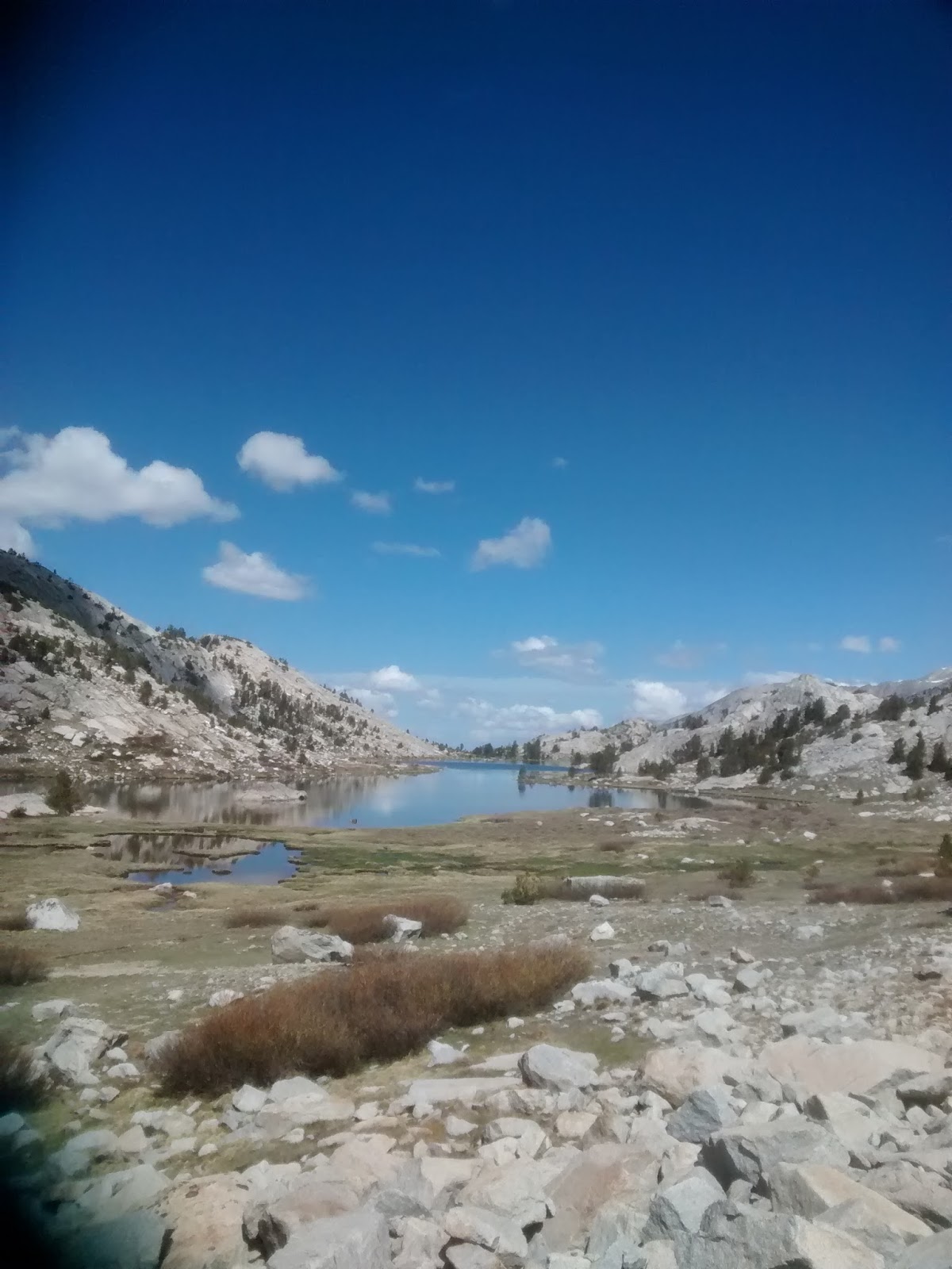
There are multiple lakes on the trails leading to Kearsarge Pass


Looking west of Kearsarge Pass

Looking east of Kearsarge Pass

Tuesday, 19 May 2015

19 May. People

While the majority of a PCT hike is spent alone with one's thoughts while walking on the trail or resting in a sleeping bag/tent, as humans are generally social beings, your interactions with other people greatly impact your experience.

If trends hold, then for 2015, the Pacific Crest Trail Association will have issued over 3,000 permits combined to thru-hikers (planning to complete the entire trail, roughly 60%) and section hikers (targeting more than 500 miles hiking but not the entirety of the trail, roughly 40%).  I expect I'm in the"early" group; the majority of hikers start later in April or May; there's a kickoff event in late April at Lake Morena that attracts thousands of hikers, previous hikers, volunteers, and vendors.

I've met about eighty other hikers on the trail.  Gender percentages are about 75-80% male and 20-25% female.  Age-wise, there seems to be a three-way split between people in their early 20s, in their late 30s/early 40s, and in their sixties; that is, not surprisingly, most hikers are either young (without families or careers) or retired.  Of those I've spoken with in a little more detail, about half of the hikers are from the west coast of the U.S. -- the PCT trail states of California, Oregon, and Washington.

Professional backgrounds are wide-ranging, from engineer to microbiologist to accountant to express delivery driver to temporary worker.  There's even a family of four with two children who are walking north to Canada!  What everyone shares is an enjoyment of maxing out on fresh air and the outdoors while carrying a heavy bag up and down mountains and thinking about finding water.

At this time of the season, you predominantly run into other hikers not hiking on the trail itself but rather stopping at water sources, resupply towns, and at "trail angels" who open their homes (or, most often yards) to hikers for the night.  Hikers will chat about the trail; how much water you're carrying, how far you're going that day, the gear you're using, the weather.

Trail angels hosting hikers for the night are a marvel of generosity.  While there will be rules, and while they may be dependent on monetary donations, all of these angels will be donating their time every single evening during hiking season to supporting complete strangers on their hikes. Sometimes there are showers, sometimes food, sometimes transport to resupply, and sometimes all three.  For hikers, after days in the wilderness, even a brief contact with civilization can be rejuvenating.  The best night of sleep that I've had on the trail was in the Anderson's backyard in Green Valley, in spite of the cold and the blazing full moon.  I suspect that this was because of the camaraderie that evening with the other half-dozen hikers and the genuine warmth of the Andersons and their nightly hosted "taco salad"/burritos.  The Andersons have hosted thousands of hikers over 15 years; their home, Casa De Luna, provides self-described "hiker daycare" and has been called affectionately a vortex, with the backyard also earning nicknames, including Narnia.

Other trail angels provide "trail magic", where you find unexpected water and other beverages and snacks on the trail, and sometimes even seating.

Of course, the trail looms over all of this, as all hiker conversations end with people returning to their hikes.  I hit the trail again on Wednesday, to climb into the Sierra Nevada and the crown jewels of the National Parks in California -- Kings Canyon, Sequioa, and Yosemite.  The trail will change in character, as water sources will be much more frequent and elevations much higher -- on the order of ten thousand feet, rather than five-six thousand.  Data connections will be few and far between, so I expect long gaps in my blog updates.

Friday, 15 May 2015

10 May. Mile 652: Walker Pass. Elements

A combination of a slow writer, no off days, and a four day stretch without cell service has left a gap in my blog.  It's been an eventful trip since Green Valley, particularly with the weather.  After spending two nights with "trail angels" (more to come in a separate post), the treck into Kern County, California has been marked by exposure to a sequential set of elements.  First, the sun, as there was a full day treck across flat, shadeless desert land heading into the Tehachapi Mountains.  Next, the wind, as the pass between where the Tehachapi Mountains end and the Sierra Nevada range starts is the location of one of the largest wind turbine farms in the world.  What I imagine were 60 mph winds snatched away my sunhat in my ascent (lesson for me; put my hat away during those kind of winds.  My temporary replacement has been wrapping a T-shirt around my head and holding it in place with a headlamp).  Then, snow and ice, as ironically during one of the driest stretches of the trail, I ran into a storm that at peak spots left six inches of snow and hail for me to push through (happily, the daytime air temps in May meant my toes didn't face frostbite).  And then, back to sun, as just a day after trekking through snow, I was hauling 17 pounds of water on my back as I traversed the edge of the Mojave Desert.

It's May in the U.S., and a number of hikers are temporarily leaving the trail to attend events like weddings and graduations.  I, too, am taking a temporary break (as I'd been planning from the start) to close out some administrative and logistical items that I couldn't complete prior to commencing my hike.

When I return to the trail and head into the Sierras, I'll leave behind the relatively widespread cell coverage of southern California, and blog updates will be much more infrequent, on a par with this gap.

Aqueduct, sending water south to Los Angeles

Joshua Tree

On the left, a Joshua tree apart from the pack.  Sadly, for U2 fans, these streets do have names.  This road eventually turns into Aqueduct Road.

Wind farm, south of the Tehachapi Mountains

Wind farm, north of the Tehachapis

High altitude pine forest, Kern County

Pacific Crest Trail marker.  The crest at the top is a favorite sight for PCT hikers -- it shows you haven't strayed from the path

Western side of Mojave Desert.  Luckily, temperatures on this day were mild, and there was a breeze

Friday, 1 May 2015

30 April. Mile 458: North of Agua Dulce.

30 April.  Mile 458: North of Agua Dulce.

The hiking through the San Gabriel Mountains has been challenging.  More elevation swings, two nights of high winds, three days of dodging poodle dog bush and the rash it induces, and then Wednesday, when in coming down the mountains, hikers run into an eight mile stretch without shade and with white slopes that further reflect the sun at you.  I've had some kind of virus the past two days, with fatigue, slight nausea, and some sneezing and congestion.

Wednesday afternoon I spent at the KOA Acton campground; a nice respite, with a shower, laundry time, and snacks.  It was a noisy evening next to a busy road that the locals use to get into LA, and train tracks nearby.

Sleep has been a bit of a challenge on the trail.  I may need to upgrade my sleeping pad to an air pad, which adds comfort at the expense of weight and risk of punctures.  Every night has involved tossing and turning, even when there hasn't been traffic noise or wind shaking the tent.

Thursday afternoon I waited out the heat in the small town of Agua Dulce, where I picked up several days of food and had lunch at the Sweetwater Cafe.

Friday, I'll try to make my way to Casa de Luma, home to trail angels who host hikers in Green Valley.

Pines outside of Wrightwood

View from San Gabriels

Poodle dog bush

Vazquez Rocks Park, outside of Agua Dulce